"The outstanding scientific discovery of the twentieth century is not television, or radio, but rather the complexity of the land organism. Only those who know the most about it can appreciate how little is known about it." — Aldo Leopold, A Sand County Almanac (1966)
Leopold names the problem before we do. The defining fact of our discipline is not any single technique but the sheer complexity of the thing being managed—a complexity so deep that expertise mostly teaches you the size of your own ignorance.
That same thinking is what shaped LandPulse, a satellite tool I have been building for foresters. I want to describe it plainly here, including where it falls short, because a tool that oversells itself is worse than no tool. I am looking for up to five foresters per region who are willing to check it against ground they know and send feedback, in exchange for a free six-month beta account.
Ask a forester what the job comes down to, and after the caveats fall away you can usually reduce it to a handful of questions. They are deceptively plain. Each one opens onto a literature no single person could hold, but the questions themselves are simple enough to fit on the back of a napkin:
- What do we have?
- What is changing or threatening it?
- What should it look like?
- What do we take, and what do we leave?
- How do we know if we got it?
These should form a loop: the last question feeds back into the first two, and the cycle begins again—ecological forestry at its core. The theme of the invisible shaping the visible runs underneath all five, and it is the reason satellite intelligence has a place in forestry at all.
The invisible shapes the visible
"One of the penalties of an ecological education is that one lives alone in a world of wounds. Much of the damage inflicted on land is quite invisible to laymen. An ecologist must either harden his shell and make believe that the consequences of science are none of his business, or he must be the doctor who sees the marks of death in a community that believes itself well and does not want to be told otherwise." — Aldo Leopold, A Sand County Almanac (1966)
The damage is there—but it is hardly visible to anyone without the training to read it, and often invisible even to the trained eye at a single moment, because it hides in time and space rather than in plain sight. The pure protectionist does not see it, nor does the short-term industrialist; each arrives with a fixed view of what the land should look like, and thus a reason to stop looking. The practical extension of Leopold's observation is this: if seeing the invisible is the ecologist's super-power, what could help a forester see a little more of it, across more ground and more years, than one person standing in one stand can?
A forester standing in the woods sees the visible forest: the stems, the crowns, the spacing, and the light available for regeneration. But not all of what determines that forest's fate is available at a single moment. Forces that decide whether a desired future condition is achieved can be invisible because they are the wrong size for a human on periodic site visits to perceive. Some are invisible because they are literally underground: nutrient cycles, the seed bank, and the deep soil moisture that a dry-season canopy is quietly living off. Some are invisible because they are too slow: climate drift measured in decades, the gradual encroachment of conifers into a meadow, the multi-year moisture deficit that precedes any visible mortality. Some are invisible because they are too brief: the disturbance you did not learn about until it was too late to act on. Some are spread across time in a way no visit can capture. And some are invisible because they are a complex interaction of all of the above.
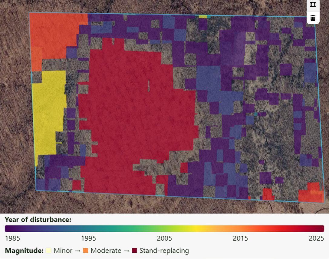
This is where remote sensing can help, within limits. Satellites do not see the invisible directly either. No satellite images a mycorrhizal network or watches climate change happen. What they offer is a record of the visible, kept consistently across every acre and every year since the mid-1980s. You cannot watch a meadow close in, but you can compare 1985 with today. You cannot visit every stand each summer, but you can be told which ones look different from last year. LandPulse is not a substitute for standing in the woods, but it can help you decide where best to stand.
With that theme in hand, the five questions read differently.
As a forest ecologist who has spent twenty-five years walking other people's forests, I have been fortunate to see numerous examples of excellent forestry—much of it deeply aligned with ecological forestry principles—and to see the same challenges surface across very different landscapes. Some of the hardest are multi-faceted: difficulty regenerating desired species, where past practices, deer, climate, and inconsistent seed crops each contribute and none is the whole story. Conifer encroachment altering fire regimes and drawing down western water tables. Changing markets and new pests and pathogens that shift priorities faster than plans can absorb. These challenges arrive at the wrong speed, or the wrong scale, to be caught by someone making a quick site visit on a non-industrial property. The monitoring and knowledge base needed to stay on top of it all dwarfs the available resources—not through carelessness, but because we have been asking one person to hold one landscape across one century in a single head.
Of the five questions, satellite monitoring helps least with the two that turn most on a forester's judgment. What should it look like is and should remain deliberately human—the desired future condition is where the landowner's objectives and the forester's ecological judgment live, and no satellite chooses it. What do we take and leave stays the forester's prescription; LandPulse's Silva module will pull together relevant guidance from field handbooks such as Forestry for the Birds and from USFS research papers, but it is a reading list, not a prescription. Where a satellite record has something to add is at the questions that occasional boots on the ground cannot fully answer: what is changing, and how do we know if we got it. And it can give a rough first answer to what do we have—rough being the important word.
What it can and cannot do, so far
I have been testing LandPulse against field data it never saw while it was being built: 845 cruised stands on Minnesota state forests, about 2,500 Bureau of Land Management stand exams in Oregon, and 282 research plots in Idaho, Oregon and Washington where crews measured individual tree heights. The results are useful and humbling in about equal parts.
Height. This is the strongest number, because it is read from a canopy height map built from aerial photography rather than inferred from something else. On the research plots, LandPulse's dominant height came within 25% of the field value on about eight plots in ten, and within 10 feet on about half. Across all 282 plots it averaged 72 feet against a measured 75.
Stands and cruise layout. Draw a property and LandPulse proposes stand lines from satellite image patterns, canopy height, the mix of hardwood and softwood, disturbance history and terrain, then places random cruise points in each stand, ready to load into a GPS. The lines are a rough first draft: you can merge stands that belong together, or load your own stand map—even a fifteen-year-old one—and see what each of your stands reads like today.
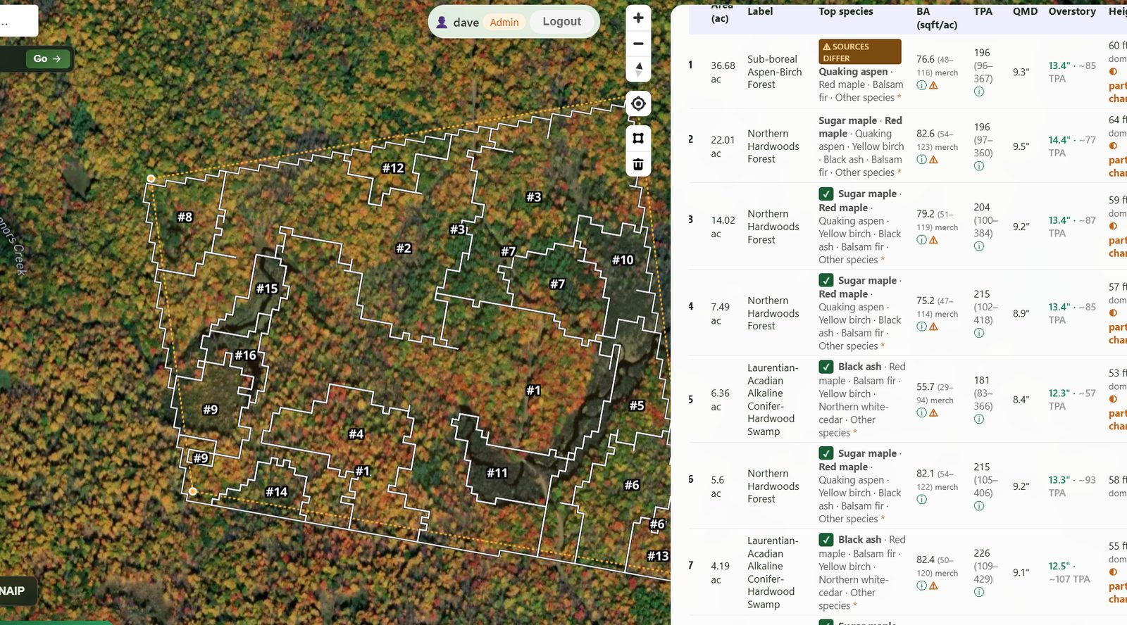
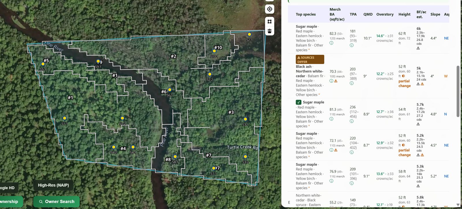
Basal area. For a single stand, the estimate lands within 25% of the cruise a little over half the time—better in the wet forests of western Oregon, worse in the dry interior West, where it is closer to four stands in ten. Averaged over the stands on a property or a district it does much better: the Minnesota average came out at 82 square feet per acre against a cruised 81, and Oregon at 204 against 199. So it is reasonable for a first look at a property, and not reasonable as the number you mark timber to. Every figure in the app comes with a range, and the range is wide on purpose.
I expect these numbers to improve. Aerial and satellite imagery keeps getting sharper and more frequent, and every set of cruise data the models are checked against makes the next version better.
Volume, diameter, trees per acre and species. These are more challenging, and the app gives rough estimates. Volume, diameter and trees per acre are built on top of basal area and height, so their errors stack: in the Oregon tests the board-foot estimate was within 30% of the exam on about half the stands. Treat it as an order of magnitude, never as a basis for a sale. I expect these to improve with better regional form factors.
Change and forest health. The forty-year disturbance history is the part I trust most for heavy events—it reliably finds and dates the year of mortality, the harvest, the burn, the blowdown. Forest health detection from Sentinel imagery, and the screens for particular problems such as conifer defoliation or oak decline, are a work in progress. They flag places where the canopy looks different from its own past, and in some cases the intensity, timing and pattern of the change point to a likely cause, such as spruce budworm. They miss light thinnings and slow declines, and they raise false alarms after drought, late frost or a cloudy season. I welcome foresters' help in checking them against field-confirmed cases. For now, read a flag as "go and look"; over time I expect these signals to get sharper.
Does it replace a cruise? No. The most it has shown is that where some stands on a property have been cruised, those plots can be used to correct the satellite numbers on the stands that were not, and that this cut the error on the uncruised stands by about a fifth. That is worth having. It is not a reason to leave the prism in the truck.
Beyond the stand table
The same forty-year record supports a set of screening layers that answer narrower questions. Most are built on public data and published models, and I have not tested them against field data the way I have basal area, so read them the same way as the health flags: as a reason to go and look.
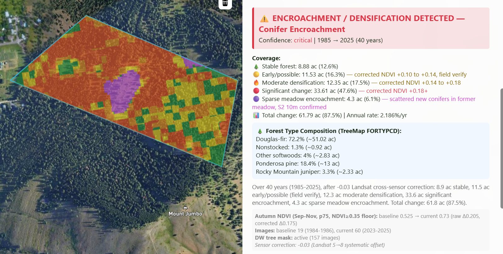
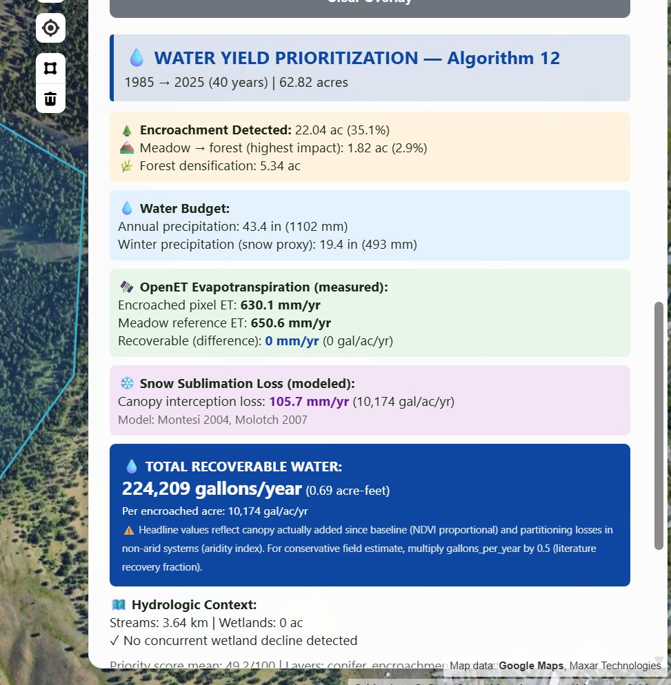
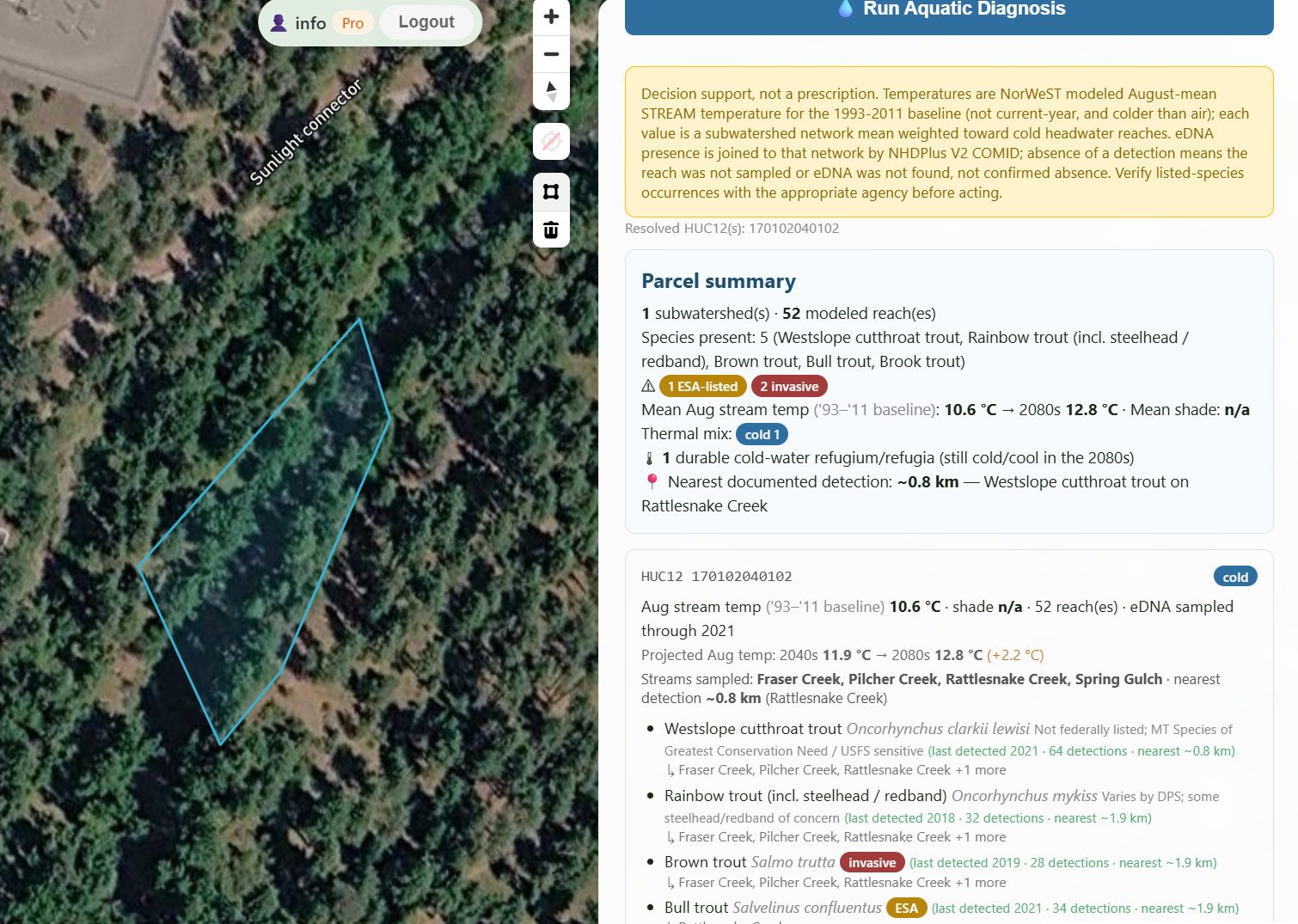
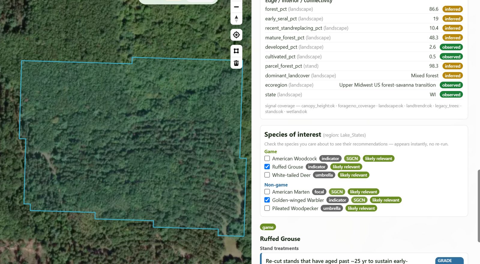
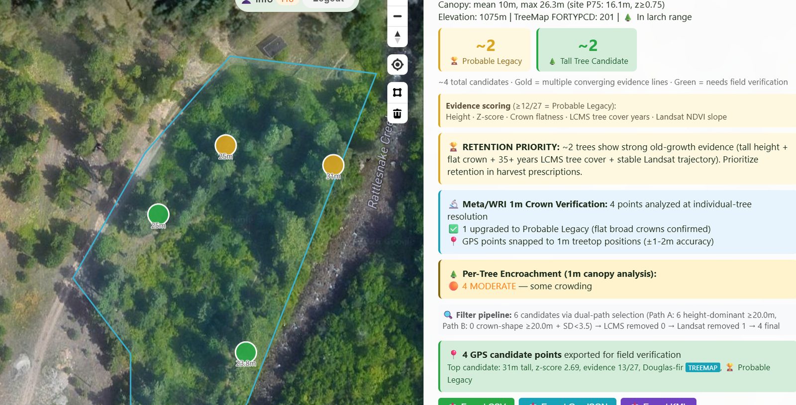
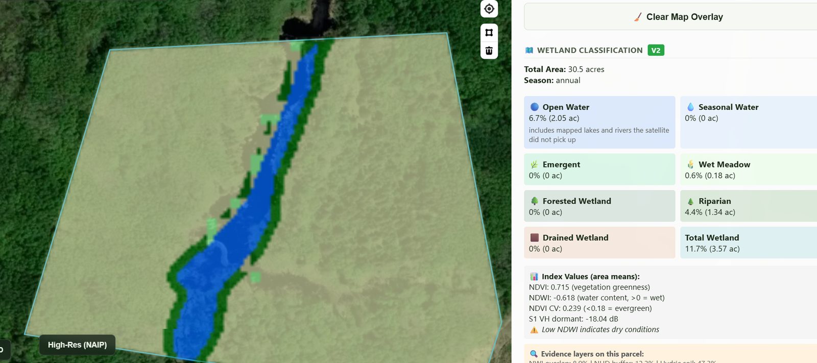
Alongside these: forage quality, archaeological site probability, carbon stock and change, regeneration monitoring, a green-tree retention calculator, monitoring for FSC, SFI and SBP certification, and aquatic and terrestrial invasive species.
The shape of the whole
Five questions, forming a loop, and a tool that is honest help with parts of two or three of them—mostly the threats that fall out of a busy mind, and the monitoring that is too often opportunistic.
I think of LandPulse as a modest extension of the forester's perception into time and space, and a memory for a discipline whose outcomes outlive the people who design them. It grows out of respect for how hard the job is—an acknowledgment that we have been asking the ecological forester to hold a whole landscape across a whole century in a single head. A satellite does not lift that burden. It can take a little of the remembering off your hands, and point to the stand that most deserves your next visit.
What a forester gets today
In practical terms: draw or select a property and LandPulse divides it into draft stands and gives each one an acreage, a softwood–hardwood split, canopy and dominant height, basal area, average diameter, trees per acre, and a rough merchantable volume in board feet and cords—every number shown with a range rather than a single figure. You can merge stands or bring in your own stand map. Stands that have been cut or damaged since the underlying imagery, or that are young regeneration, are flagged so that you do not trust an out-of-date number. A forty-year disturbance history shows what happened before you inherited the ground, and screening layers point to recent canopy change, likely invasive plants, conifer encroachment and wetlands worth checking in person. It will lay out cruise plots for each stand and export them to your GPS as GPX or KML, and the stand map itself exports for use in the field. The Silva module gathers published silvicultural and wildlife guidance for the forest type in front of you. All of it is meant for the desk work before and between visits: deciding where to walk, how many plots to put in, and what to look at when you get there.
Help test it against ground you know
LandPulse is a work in progress, and some of its numbers will be wrong on your ground. I am looking for up to five foresters per region to run it on a property with a recent cruise and tell me how far off it was. In exchange: a free six-month beta account. Places are limited.
Apply for a free beta account → Feedback on where it misses, and on what would make it worth opening before a site visit, is what I am after.